
Digital Mapping Saltaire: Creating an Immersive Digital Heritage Experience
In this blog post, Digital Community Heritage interns Tula Bowes and Isabelle Parker explore how digital mapping and immersive heritage tools were used to create an immersive digital experience of the World Heritage Site Saltaire. This project was led by mentors Simon Popple and Chris Birchall.
How can digital technologies help people experience heritage in new ways?
During our internships with the Digital Creativity and Cultures Hub, we worked with World Heritage UK to develop immersive digital resources for Saltaire, a UNESCO World Heritage Site, as part of the UK Industrial Heritage Trail.
Industrial heritage sites preserve the technologies, labour and social changes that shaped the modern world. They also hold deep cultural value, contributing to collective memory, local identity, education and regeneration across the UK. However, interpreting these complex histories in accessible and engaging ways can be difficult, especially when sites are large, geographically dispersed and working with limited resources.
Our project therefore explored how low-cost, user-friendly digital tools – including digital mapping, 3D modelling and podcasting – can help make heritage more accessible, immersive and engaging for different audiences. In this blog, we reflect on developing three interactive maps for Saltaire, and on the archival research, community expertise and digital methods that shaped the project.
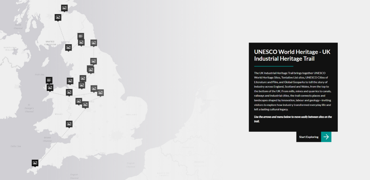
Screenshot of the UK Industrial Heritage Trail map. Image Credit: World Heritage UK.
The UK Industrial Heritage Trail
The UK Industrial Heritage Trail formed the foundation of the project. Developed in partnership with World Heritage UK, the trail brings together 22 UNESCO designations across England, Scotland and Wales within a single digital platform.
The trail connects World Heritage Sites, Global Geoparks and UNESCO Creative Cities, encouraging users to explore the UK’s industrial heritage either as a cross-border journey or through individual sites. Rather than presenting these places separately, the map helps users see connections between places, industries, landscapes and shared histories.
To create the trail, each UNESCO designation was represented as a point within an interactive map developed using StoryMapJS. Working with participating heritage organisations, we collated site descriptions, photographs and links to existing digital resources, creating a single gateway through which users can discover industrial heritage across the UK.
For us, this showed how digital mapping can make heritage easier to explore. It allows users to move through information at their own pace, broadens access for people who may not be able to visit in person, and supports more informed and sustainable forms of heritage tourism.
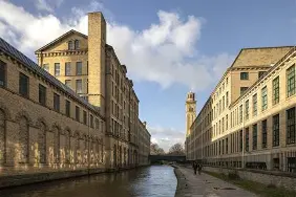
Saltaire Mill. Image Credit: Bradford Council
Developing the Saltaire Prototype
Alongside supporting the wider UK Industrial Heritage Trail, our main role was to create an immersive digital prototype for Saltaire UNESCO World Heritage Site. The prototype acted as a pilot for a more detailed extension of the trail, exploring how low-cost digital technologies could be used to create a richer, place-specific visitor experience.
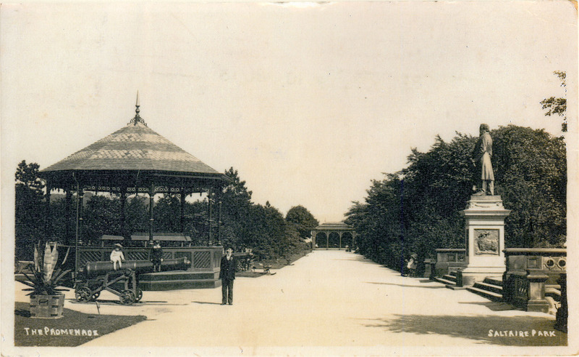
Victorian photograph of Roberts Park. Image Credit: Saltaire Collection
Saltaire was an ideal site for this because of the depth of its industrial, architectural and community history. While the UK Industrial Heritage Trail provides a broad overview of sites across the country, the Saltaire prototype allowed us to test what a more detailed digital experience could look like at one World Heritage Site.
Coming from different academic backgrounds meant that we approached the project from a range of perspectives. Tula, a Global Creative Industries student, brought interests in arts and heritage, accessibility, audience engagement, and the history of photography and visual culture. Isabelle, an English and Sociology student, brought interests in sustainability, public engagement, literature and culture, informed by a previous year in industry working in human rights and social sustainability.
These perspectives shaped the project from the beginning. We wanted to think not only about how Saltaire’s history could be interpreted, but also how visitors might travel there, move around the site, access information and connect with its stories.
To do this, we developed three interactive StoryMaps:
- Saltaire Digital Heritage Trail – exploring the history, architecture and stories behind key locations across the World Heritage Site.
- Accessibility in Saltaire – identifying accessible routes, facilities and practical information to support inclusive visits.
- Sustainable Travel in Saltaire – encouraging environmentally sustainable ways of reaching and exploring the site.
Together, these resources were designed to support visitors before, during and after their visit, helping them engage with Saltaire through historical, practical and contemporary perspectives.
Explore the three maps here: Saltaire prototype – Industrial Heritage Trail
Researching Saltaire through Archives and Expert Consultation
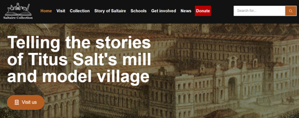
Screenshot of ‘Saltaire Collection’ website, a digitalised archive
A fundamental aim of the Saltaire Digital Heritage Trail was to showcase the Saltaire Collection. Embedding links of the collection’s artifacts, historical photographs and oral histories within the map’s historical summaries brought the history to life, allowing users to experience the history through a range of multi-media. Archival references also included items from the University of Bradford Collection and Historic England Archive which have a strong selection of artifacts relating to Saltaire. Core understandings of the heritage site were further attained through academic literature, broader web searches and, most importantly, through expert consultation.
Outside our independent archival research, what was essential to developing content which represented Saltaire accurately was the connection we made with Maggie Smith, a trustee for the Saltaire World Heritage Education Association and Manager of the Saltaire Collection. Through her expert knowledge of Saltaire we were able to cross check facts and information with her research and produce a series of oral histories on key figures of Saltaire.
From the beginning, both ourselves and Maggie were determined to explore a diverse range of figures including how women and migrant workers shaped the ethos, economy and culture of Saltaire. We collected oral histories of, of course, Titus Salt himself but also William Fairbairn, Catherine Salt, James Roberts, Medina Griffiths, Ethel Magill and Feliks Czenkusz. The purpose was to offer a more immersed resource of both well-known and virtually unknown figures of Saltaire, reshaping the narrative of its history through a more humanising and universal approach to storytelling.
Primary research was collected through interviews with locals who lived and worked in Saltaire. This included a conversation with a long-term resident of Saltaire, Ros Garside, who describes what modern day life is like in Saltaire’s model village and got us up to date with all the current events and festivals happening in Saltaire! We also interviewed Brandi Hall-Crossgrove, World Heritage Officer of Saltaire, to discuss her role within the village and to gain her perspectives on the objectives, functions, and future direction of the wider UK Industrial Heritage Trail project. Drawing from a range of perspectives allowed us a deeper understanding of Saltaire’s history and modern-day significance as a heritage site.
All oral histories and interviews can be found here.
Field work: Immersive digital heritage methods
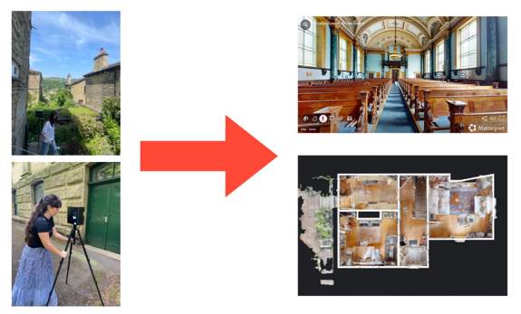
Photos of Tula (top left) and Isabelle (bottom left) working with the Matterport cameras and the 3D model outcomes of the United Reform Church (top right) and an original workers house (bottom right).
The Process of learning and using the Matterport Cameras
We used Matterport cameras to create the 3D models of the United Reform Church and an original worker’s house. These cameras capture 360 degree views and once uploaded on the software, creates a completed model, using AI to fill in any missing spaces. We ran into several learning curves and processes while using the equipment:
- Trial and error of using the camera: The Matterport camera typically favours indoor settings so when trying to capture an outdoor setting we needed to adapt to different weather and light to ensure clear images. We found that even outside, if we positioned the camera next to a clear structure, like a wall or building, it would produce better results.
- Managing equipment in historical buildings: When capturing the 3D model of the original workers house we encountered some challenges due to the historic structure of the building. For example, the stairs to the basement were made of stone and quite uneven so adjusting the tripod to ensure a stable and level position while capturing the space was essential.
- Annotating models: Once the models were uploaded and fully captured on the software, we were able to edit the model by adding annotations. This meant we could highlight information points and key features within the 3D models.
- Utilizing 3D models in different ways: One of our practice models captured the exterior of the United Reform church. Initially, this model didn’t have a clear purpose on the Saltaire Digital Heritage Trail however we later discovered its use on the Accessibility Map as it highlighted the only wheelchair-accessible door to the building.
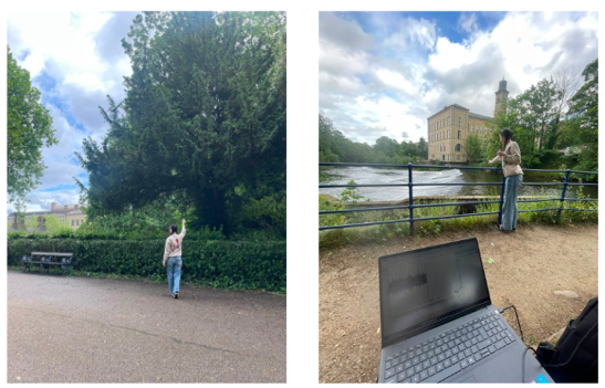
Photos of Tula collecting soundbites around Roberts Park including bird song and the sounds of the River Aire. Unfortunately, as it was particularly windy, only the bird song came through clearly!
Ambient sound bites were collected across Saltaire so users who couldn’t visit in-person could experience the site as immersively as possible. This included bird song from Roberts Park and organ playing from the United Reform Church. This way users can listen to the sounds whilst either exploring the 3D model or reading about its history through the map.
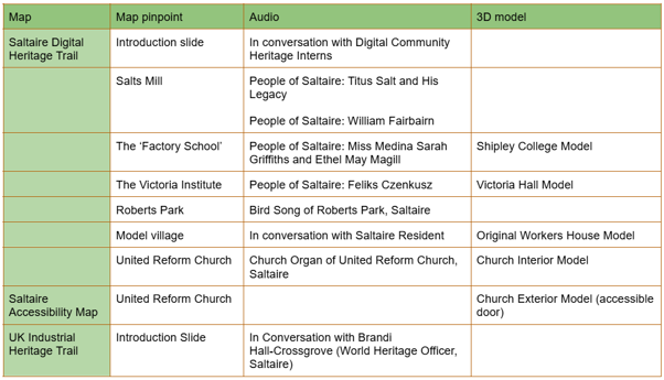
Table of all immersive content produced for Saltaire Digital Heritage Trail
Conclusion
In conclusion, this internship has been one of the most interesting and formative experiences of our academic careers. Hear more from us through our podcast as we reflect upon our experience working on the project.
As interns mainly working on the Saltaire prototype, we are excited to see all 22 industrial heritage sites UK-wide implement some or all of these digital methods into their own digital maps. Serving as a foundation for future development, this project is the first step towards a richer and more immersive digital resource on industrial heritage.